• Skip to primary navigation
  • Skip to main content
  • Texas A&M Forest Service
  • Texas A&M Veterinary Medical Diagnostics Laboratory
  • Texas A&M AgriLife Extension Service
  • Texas A&M AgriLife Research
  • Texas A&M College of Agrculture and Life Sciences
Texas A&M College of Agriculture and Life Sciences
Lidar Applications for the Study of Ecosystems with Remote Sensing Laboratory
  • Menu
  • Home
  • Projects
    • Current Projects
      • Unmanned Aerial Systems for Agriculture
      • NASA ICESat 2 Science Definition Team: Improving Estimates of Forest Biophysical Parameters with an Integrated Multi-Scale Approach
      • NASA Rapid Response: Using LiDAR to develop a climate-driven model of the disintegration and decay of trees killed during a severe drought
      • USDA NIFA: Aerial and Ground Phenotyping Analytical Tool Development for Plant Breeders Using the Maize G2F project
      • ESSM Sonora Savanna Research Initiative
    • Past Projects
      • Past Projects
  • Publications
  • Media
  • People3
  • Contact
  • Join Lab
Home > About

About

popescu

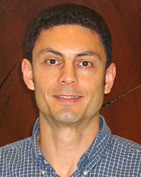
Dr Sorin Popescu

The LiDAR Applications for the Study of Ecosystems with Remote Sensing (LASERS) laboratory, with PI Dr Sorin Popescu, at Texas A&M University specializes in the research and academic advancement of remote sensing and spatial sciences in general for natural resources assessment, monitoring, and management.

The LASERS lab focuses on the development of  improved algorithms and software tools for multi-sensor data fusion and for processing LiDAR data, which  enable the estimation of forest biophysical parameters, such as stand density, tree height, crown diameter, volume, and biomass. Such forest data enable better informed strategies to natural resource management, including forest growth and loss and are essential inputs for other scientist and industry involved in carbon modelling and timber. The lab is also involved in the application of unmanned aerial systems and the development of specialized crop phenotypying methods to support the precision management of crops and natural resources.

The lab engages a number of PhD students and postdoctoral researchers in various research areas under the lab’s research agenda and collaborates with inter-disciplinary scientists to promote the use of geospatial technologies.

  • Compact with Texans
  • Privacy and Security
  • Accessibility Policy
  • State Link Policy
  • Statewide Search
  • Veterans Benefits
  • Military Families
  • Risk, Fraud & Misconduct Hotline
  • Texas Homeland Security
  • Texas Veterans Portal
  • Equal Opportunity
  • Open Records/Public Information
Texas A&M University System Member